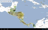
Central America Topo Maps is an intuitive outdoor navigation application featuring detailed 1:50,000 topographic maps of countries like Guatemala, Honduras, El Salvador, and Nicaragua. Similar to Garmin or Magellan GPS devices, this app is designed to enhance your outdoor adventures, whether you're hiking, biking, or engaging in other activities where accurate mapping is crucial.
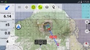
The application comes with a suite of essential navigation features. Users can create and edit waypoints for personalized navigation, and although live route navigation isn't available in the free version, plotting points of interest is still an option. Track recording is possible, complete with an elevation profile and speeds, ensuring an effective journey monitoring. The Tripmaster component offers comprehensive information, including odometer readings and average speed.
Even without features like GPX and KML exports and route creation, which are limited in the free version, a range of topographic map layers are still at your disposal. These layers include not only the detailed topo maps but also various other sources such as Google Maps, Bing Maps, and Open Street Maps, catering to multiple needs.
Despite advertisements and a cap of three waypoints and tracks, searching functions remain available to locate place names, Points of Interest, or streets. Certain utilities are missing, like bulk downloads for offline use and hill shading overlays; nevertheless, these are minor tradeoffs when considering the comprehensive mapping offerings.
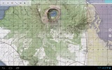
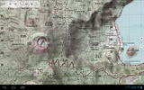
For enthusiasts seeking off-the-beaten-path experiences or historical routes, the topographic maps uncover a multitude of minor roads, paths, and 4WD tracks that are typically absent in conventional mapping services. Detailed topography featuring contour lines, vegetation, and urban areas provides the granularity needed for precise navigation.
As you plan your outdoor activities, consider the value of large-scale topo maps in remote areas. While city explorers may revert to more familiar map services, the features of this app can be a critical asset for your backcountry explorations, particularly in zones where cellular service is nonexistent.
Preloading maps is recommended for uninterrupted navigation, and user feedback is welcomed to help guide future enhancements. In summary, for precise and reliable mapping in Central America's challenging terrains, Central America Topo Maps stands out as a beneficial tool.
Requirements (Latest version)
- Android 7.0 or higher required







Comments
Excellent app, but this latest version did not meet my needs